![]() Coordinate
GIS
Coordinate
GIS
 |
|
| HOME | SCROLL DOWN |
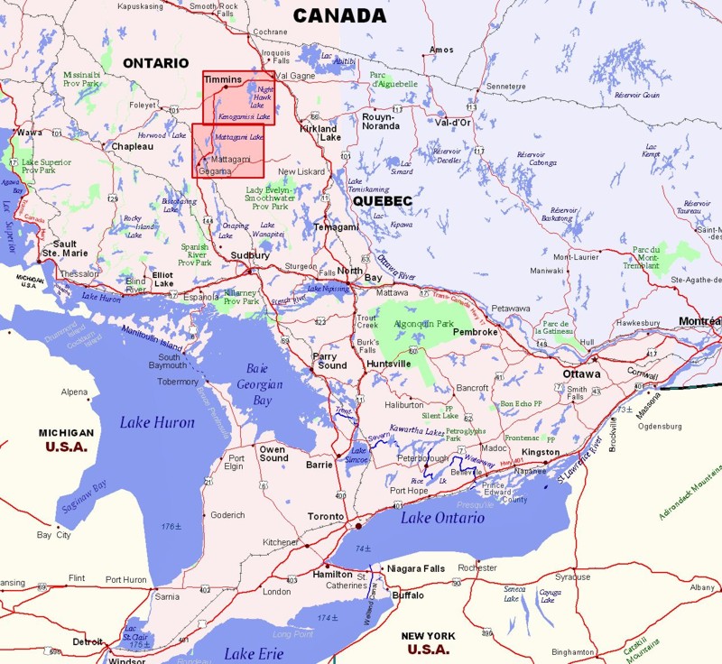
| Region of Ontario Covered by Timmins - Gogama - Mattagami - Fishing & Recreation Map | |
| Purchase Maps GIS Services Contact Us Next Map » 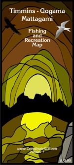 |
 |
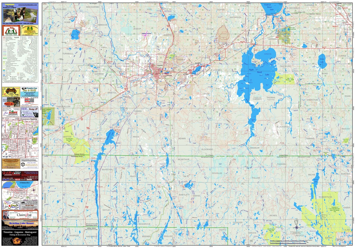
| Timmins - Gogama - Mattagami - Fishing & Recreation Map 28 x 40 inches (contours are not shown here) - These are simplified pictures of both sides of the map. Scroll below and you will see the legend and the items that are shown on the map. Included in the sidebars are town maps of downtown Timmins & Schumacher. North Side of Map Shown Below: Night Hawk Lake, Kamiskotia Lake, Moose Lake, Frederick House Lake, Kenogamissi Lake, McArthur Lake, Radisson Lake, Peterloong Lake, Jowsey Lake, Muskasenda Lakeand many others. Hwy 144 meets Hwy 101 which goes into the City of Timmins seen in the middle of the map. |
|
 |
|
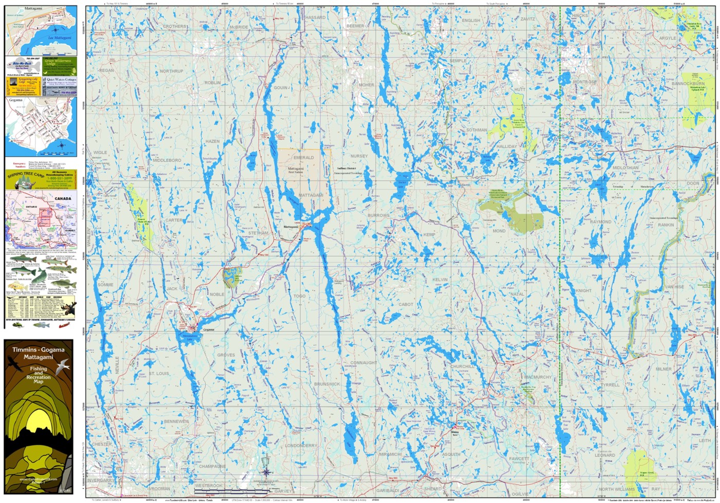
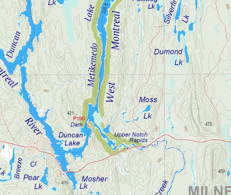
| South Side of Map Shown Below: Mattagami Lake, Minisinakwa Lake, Sinclair Lake, Mesomikenda Lake, Nabakwasi Lake, East Shining Tree Lake, Okawakenda Lake, Kapiskong Lake, Tatachikapika Lake, Firth Lake, Duncan Lake, Halliday Lake and many others. The towns of Gogama and Mattagami are shown with detailed maps of them in the side bar. Dark green areas delineate the provincial parks of the West Montreal River, LaMotte Lake and Grassy River-Mond Lake Lowlands. Yellow areas are Provincial Conservation Reserves. |
|
 |
|
Map Detail along Highway 560 showing contours, contour elevations, spot elevations, lake elevation boat launch, picnic area, campsite, township boundaries, canoe route and portage and provincial park area. |
|
 |
|
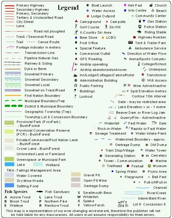
| Legend Items | |
 |
|
| HOME Contact us at: info@CoordinateGIS.com | |
|
Find us here via www.CoordinateGIS.com or via www.theMapLady.ca
|
|
|
|